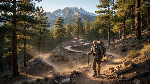
The Manitou Incline is short by Colorado standards — well under a mile — and that’s exactly what makes it deceptive. Built on the roadbed of a former cable-car incline railway, it climbs roughly 2,000 feet in less than a mile via a relentless stretch of railroad-tie steps, at an average grade of around 41% and a maximum grade near 68% in places. There is no meandering, no switchback relief, and very little flat ground to recover on. It’s less a hike than a stairmaster carved into a mountainside, and it draws serious trail runners, first-time visitors curious about a local landmark, and everyone in between.
This guide covers the numbers, the reservation system that governs access, and what to actually expect on the way up.
Trail Stats
The Incline covers approximately 0.88 miles from base to summit, climbing from a base elevation around 6,530 feet to a summit elevation around 8,500 feet — an elevation gain just over 2,000 feet. The climb is made via roughly 2,744 discrete steps (some sources count slightly differently depending on how sections are tallied, generally landing in the 2,700-2,800 range), most constructed from old railroad ties set into the slope. Average grade across the full route runs around 41%, with the steepest sections — often cited around the “false summit” partway up — reaching roughly 68%.
Most hikers complete the climb itself in something like 1-2 hours, though serious trail runners train specifically to run it in a fraction of that time. There’s no shame in the slower end of that range; the grade alone makes this one of the more physically demanding short trails in the state, and altitude adds a real factor for anyone not acclimatized to the 6,500-8,500 foot range.
The Reservation System
Access to the Manitou Incline is managed through a free online reservation system, paired with a signed waiver, administered by the City of Colorado Springs. Reservations for a given month typically become available starting on the 1st of that month, and you select a 30-minute arrival window rather than a fixed climb time — the window is meant to give you time to park, prepare, and start, not to constrain how long the climb itself takes.
This system exists because the Incline sits on a narrow, single-file corridor with genuine capacity limits — too many climbers at once creates both a poor experience and a real safety bottleneck on a trail with almost no passing room in its steepest sections. Booking ahead, especially for weekend mornings in peak summer, is the reliable way to avoid being turned away at the trailhead. Same-day reservations do open up, but they’re not something to count on for a tightly scheduled trip.
Hours of Operation
The Incline generally operates on a seasonal schedule: extended summer hours running from around 6 AM to 6 PM, and reduced winter hours from around 6 AM to 3 PM. Because conditions and posted hours can shift with weather and city maintenance schedules, checking the current hours directly through the City of Colorado Springs’ Manitou Incline page before you go is worth the extra minute, particularly outside peak summer season.
Why It’s Made of Railroad Ties: A Short History
The steps themselves are a direct leftover from the Incline’s original purpose, and knowing the history explains why the surface feels so different from a built hiking trail. The corridor was constructed in 1907 as a narrow-gauge funicular railway, originally built to haul materials and pipe for a hydroelectric plant and gravity-fed waterline serving Manitou Springs and Colorado Springs — it wasn’t built for tourists at all. After the utility work was finished, the line was sold and converted into a scenic tramway, and financier Spencer Penrose bought and upgraded the operation in 1923, running passenger cars up the same grade for decades as a paid attraction.
That ran until 1990, when a rockslide destroyed a significant stretch of track, exposing rebar and mangling the rail bed. The railway was never rebuilt; instead, the rails were pulled and the wooden ties were left in place, and hikers and trail runners gradually adopted the abandoned incline as an unofficial fitness route long before the city formalized access with the current reservation system. That history is also why the grade feels so uniform and relentless compared to a natural hiking trail — it was engineered for a rail car’s mechanical limits, not for a hiker’s comfort, and the tie spacing reflects that engineering rather than any trail-building convention.
The Descent: Barr Trail, Not the Incline
One detail that surprises first-time visitors: descending the Incline itself is strongly discouraged and, at points, effectively prohibited due to the loose, uneven step surface and the risk of a fall onto the person behind you on a steep, narrow corridor. The standard route is to climb the Incline, then descend via the adjacent Barr Trail, which intersects near the top of the Incline and offers a much gentler, switchbacking grade down to roughly the same trailhead area. This makes the Incline-plus-Barr-Trail-descent loop a de facto standard route, and it’s worth planning for — pack for a longer overall outing than the short incline distance alone would suggest, since the Barr Trail descent adds real mileage and time. For hikers considering the full Barr Trail experience in the other direction — all the way to the summit of Pikes Peak — our Barr Trail hiking guide covers that much longer undertaking in detail.
Parking and Getting There
Parking at the Incline’s base is limited and fills quickly, especially on summer weekends — most visitors either arrive very early, use designated overflow lots with a short walk or shuttle to the trailhead, or stay within walking distance in Manitou Springs itself. If you’re building a trip around the Incline, staying somewhere you can walk or take a very short drive to the trailhead meaningfully simplifies the morning logistics tied to your reservation window. Our Manitou Springs camping guide breaks down the realistic nearby camping and RV options if you’re staying overnight rather than day-tripping in.
Who the Incline Is (and Isn’t) For
The Incline rewards a specific kind of visitor: someone comfortable with sustained, steep cardio effort over a short but demanding distance, ideally with at least some altitude acclimatization. It’s genuinely not a casual family stroll — the grade alone rules that out for most people — but it’s also shorter and more logistically simple than a full Pikes Peak summit attempt via Barr Trail, which makes it a popular choice for visitors who want a serious, quintessentially-Colorado physical challenge without committing to a 10-plus-hour day.
First-timers consistently underestimate two things: how quickly the grade compounds fatigue compared to a normal trail, and how much the altitude difference between the base and summit affects breathing, even for otherwise fit hikers. Building in rest breaks, carrying more water than a 0.88-mile distance would normally suggest, and treating the reservation window as a rough guide rather than a hard deadline for finishing are all reasonable adjustments for a first attempt.
Frequently Asked Questions
Do I need a reservation to hike the Manitou Incline?
Yes. Access requires a free online reservation and a signed waiver, managed by the City of Colorado Springs. Reservations for a given month open on the 1st of that month, and you select a 30-minute arrival window. Same-day openings exist but shouldn’t be relied on for a tightly planned trip.
How many steps does the Manitou Incline have?
The Incline is generally cited at approximately 2,744 steps, most built from railroad ties set into the slope, though exact counts vary slightly by source depending on how sections are tallied. It gains roughly 2,000 feet of elevation over that distance, in well under a mile.
Can you hike down the Manitou Incline?
Descending the Incline itself is strongly discouraged due to the loose, uneven steps and fall risk on such a steep, narrow corridor. The standard practice is to descend via the adjacent Barr Trail, which meets the Incline near its top and offers a much more gradual switchbacking route back down.
How hard is the Manitou Incline compared to a normal hike?
It’s short in distance — under a mile — but averages around a 41% grade with sections reaching roughly 68%, making it far steeper than a typical trail climb. Most hikers take 1-2 hours to complete it, and altitude (the trail spans roughly 6,500 to 8,500 feet) is a real factor even for visitors in good general fitness.
Was the Manitou Incline always a hiking trail?
No. It started life in 1907 as a narrow-gauge funicular railway built to haul materials for a hydroelectric plant and waterline, later becoming a paid scenic tramway before a 1990 rockslide destroyed the track and ended rail operations for good. The railroad ties left behind after the rails were removed became the informal — and eventually formalized — hiking route in use today.